Before the Village Green: A Short History of the Common
A short history of the common shows how shared land served different people, and offers a clear way to trace a village green’s local past.
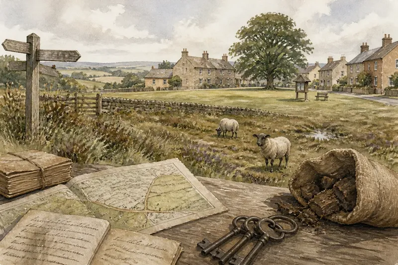
A short history of the common starts with who could use the land, not how it looks today. A neat lawn beside a village hall may have a different past from rough grazing ground beyond the last houses. Across Britain, common land took varied forms, so a local account should begin with the people, rights and rules connected to a particular place.
Common land meant rights of use, not ownerless ground
The word “common” can sound as though land belonged to everyone. Historically, common land was often privately owned, while particular people held rights to use it. Those rights might be attached to a nearby farm, house or holding, and could permit activities such as grazing animals, gathering fuel or cutting turf. The details depended on local custom and the land concerned.
Shared use did not necessarily mean unrestricted access, and common rights were not all alike. A commoner might have a recognised entitlement to graze livestock, while a visitor had no such right. Other uses could be shaped by custom, agreement or later law. A village green now used for gatherings may therefore have a different history from land where older rights still affect management.
Think of a shared kitchen shelf: several people can use it without owning it, and not everyone necessarily has the same permission. The comparison is simple, but it helps separate ownership from use. On a common, those arrangements were rooted in land, livelihood and local rules.
Match the historical account to the landscape
For a tidy village green, begin with its civic and social role. Some greens developed as open spaces within settlements; others were altered, enclosed, landscaped or formally protected. A clear lawn and a noticeboard cannot establish whether grazing or other common rights once existed. Check old maps, local records and information about ownership or management before drawing a conclusion.
For rough ground at a village edge, consider its role in the working landscape. Heath, moor, marsh and woodland could support several uses alongside farming on nearby holdings. Grazing, fuel gathering and other customary activities helped households use resources beyond those available on an individual farm. Such ground was not necessarily an empty margin; its value could lie in overlapping uses.
Where boundaries or uses changed, look at enclosure and its local consequences. Enclosure took different forms and occurred in different periods. It could consolidate land and change who could use it, while sometimes leaving common rights in place or creating new boundaries. Avoid assuming that every common was enclosed in the same way or that each change had the same effect. Local records are a firmer guide than a single national story.
A place still called “the common” may have changed in use or legal status. The name can persist in local speech or a field-name, while recognised common land need not look like a village green. For a particular site, check its management information and relevant local records instead of treating its name as proof of an unbroken history.
Trace who used the land and what they could do
Ask practical questions: Was the land used for livestock, fuel, turf or another resource? Were rights linked to particular holdings? Did access vary by season or custom? Were there disputes, restrictions or changes in ownership? Answers can show how a common fitted into village life without assuming that all residents had equal access or benefit.
Imagine a village where an old map marks open ground beside a cluster of cottages. A later parish record describes grazing rights attached to nearby holdings, but says nothing about rights for every household. Taken together, these clues support a careful account: some right-holders used the ground for grazing, but the records do not establish that it was a public park for the whole village.
Useful sources include estate maps, parish records, local histories, enclosure documents and information held by a council or land manager. Compare sources where possible: a map may show a boundary, while a written record may describe a right or restriction. Older terms can be ambiguous, so record what each source says before translating it into a modern category.
Use the question you have to guide your next search
Different questions call for different evidence. If you are trying to understand a name on a sign, look for the land manager’s description and any recorded designation. If you are tracing family or village history, search for rights and holdings as well as place-names. If you want to know what you may do there now, consult current access information rather than relying on a historical account.
- If you are curious about the village green, check: Look for records of ownership, management and changes in use; if they describe a civic space but no common rights, distinguish that history from a working common, and search parish or estate records for further clues.
- If you are studying a working common, check: Identify the resources mentioned and the people or holdings linked to rights; if a record names particular right-holders, describe their use specifically, and avoid implying that every villager shared it.
- If you have found an old map, check: Compare its boundaries with later maps and written descriptions; if the boundary changes, look for records explaining the change, and leave its cause open if none survive.
- If a place-name includes “common”, check: Compare the name with management records and historical descriptions; if those sources do not confirm common rights, treat the word as a clue rather than proof, and investigate the land’s recorded use.
- If you want to understand access today, check: Read current local access information; if it sets out permitted routes or activities, follow those terms, and contact the land manager if they are unclear.
- If sources use an unfamiliar term, check: Note the exact wording and its date; if its meaning is uncertain, compare it with a second record or ask a local archive for context rather than silently assigning a modern meaning.
Where current access, rights or management turn on a legal designation, consult the relevant land record and local rules. If a dispute depends on interpreting them, seek qualified advice.
What does the word common tell you about a village?
Did every villager have a right to use common land?
No. Rights could belong to particular people or be attached to specific holdings, rather than being shared equally by everyone in a settlement. Identify who held which rights where the evidence allows.
Was common land always open countryside?
No. It could include pasture, heath, woodland and other kinds of ground, and its appearance could change. The name alone does not reveal its former uses.
Does a village green have the same history as a common?
Not necessarily. Greens and commons can overlap in some places, but the terms describe different histories and arrangements. A green’s present appearance does not establish that it once supported common rights.
Where can you look for local evidence?
Try parish and estate records, historic maps, local archives, council information and accounts of land management. Read each source in context, distinguishing what it records directly from what you infer.
Let local evidence shape the history
The history of the common is not one tidy account of land shared and then lost. It is a varied history of ownership, rights, work and changing custom. A green can matter greatly to village life without sharing the history of a grazing common; an unshowy stretch of rough ground can carry a record of practical use.
For a specific village, identify the land, find out who used it and check what evidence survives. Search for “history of the common” alongside the place-name, then compare maps with written records. This local approach makes the landscape easier to read without asking it to tell a story the evidence cannot support.